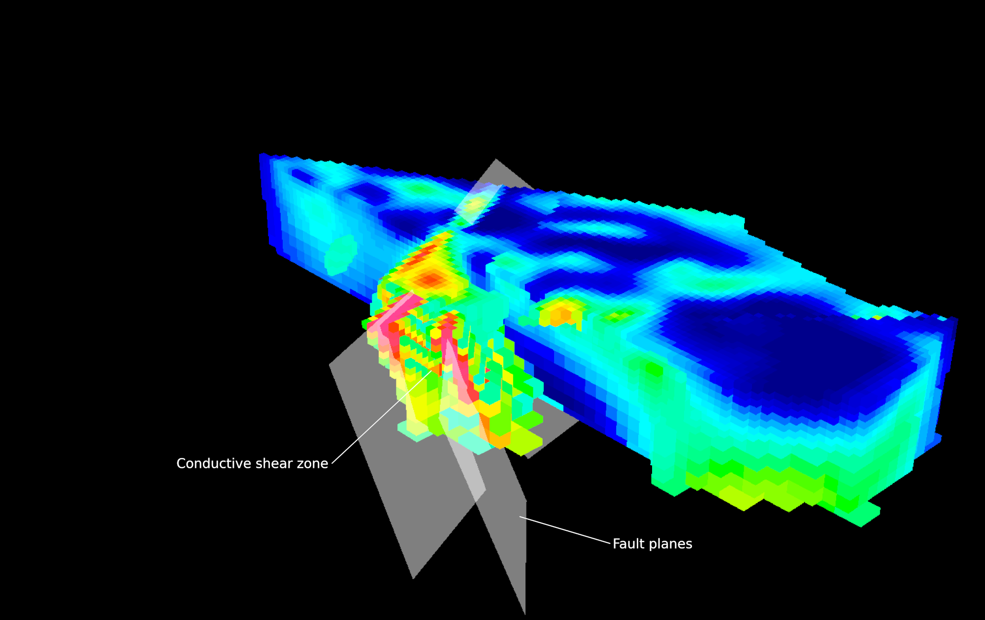
Technology

Geophysical Modelling And Inversion

“Computational Geosciences has been an excellent group to work with for geophysical data 3D inversions.  We have relied on them for imaging targets under cover for many years and they have been a key part of our exploration workflow”

Scott Urquhart
President, Managing Geophysicist
Zonge International

MODELLING

Geophysical Modelling and Inversion

Macroscopic physical properties in the subsurface reflecting geological complexities are typically at scale lengths in the order of meters. Common geophysical surveys have large spatial coverage. For modeling without local grid refinement, the 3D earth model must be discretized with a mesh containing many millions of cells, resulting in an extremely large system of equations that are demanding to solve, even with large-cluster or cloud computing resources.

Computational Geoscience avoids this numerical complexity by parsing the 3D earth model with three levels of decoupled but collocated grids where we upscale or downscale using effective medium models:

Global Inversion Mesh

A global mesh, which includes all local grid refinement, used to store the resulting physical property model of the entire survey.

Local Modelling Mesh

A local inversion mesh generated for each subset of data used in the inversion. This mesh is discretized in such a manner as to reflect the spatial sensitivity for each data subset populated with physical properties from the global mesh.

Semistructured, adaptive octree meshes, upon which the geophysical fields are simulated using a staggered-grid, finite-volume discretization enable local mesh refinement and mapping between the different meshes. These meshes have the advantage of an underlying regular structure that enables addition of fine cells only where necessary while avoiding the many complications associated with fully unstructured tetrahedral or hexahedral grids necessary for finite elements. Additionally, unlike a fully unstructured grid, the interpolation of models and fields from one octree mesh to another is a trivial operation.

For each local inversion mesh, the inversion estimates the 3D physical property model  by minimizing a constrained optimization problem that minimizes the linear sum of misfit and model functionals. The nonuniqueness of the inverse problem requires regularization so that a unique solution can be obtained by designing a model functional whose value is minimized for models exhibiting geologically-desirable characteristics. Each inversion iterates until one of multiple predetermined stop criteria becomes satisfied.

The numerical implementation of combined modeling and inversion is optimized for stably solving any geophysical field and survey configuration with high-contrast physical properties.

CASE STUDY

3D Inversion of Airborne Time-Domain EM Data

Airborne time-domain electromagnetic (EM) surveys are effective tools for mineral exploration, geologic mapping and environmental applications. These surveys can be an economical way to explore large prospective regions.