Markets

Mining

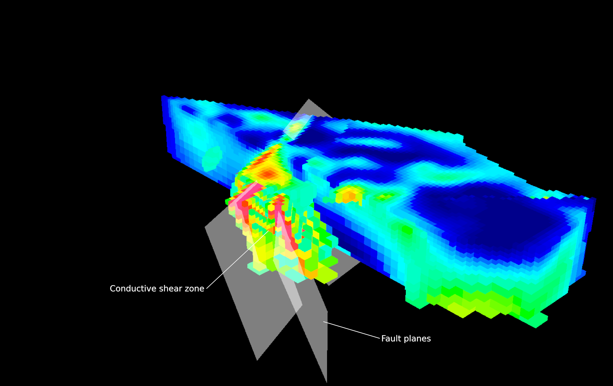
"At the Frotet project in Quebec, CGI's 3D inversion models were integral in imaging gold-bearing structures within sulphidized intrusive rocks that are completely concealed by glacial deposits and lakes. From their models, we were able to target small chargeable zones which ultimately led to the Regnault discovery in March, 2020."

Francis MacDonald
Executive Vice President of Exploration
Kenorland Minerals

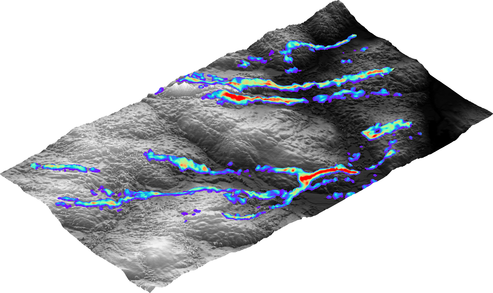
“Computational Geosciences has been an excellent group to work with for geophysical data 3D inversions.  We have relied on them for imaging targets under cover for many years and they have been a key part of our exploration workflow”

Michael Henrichsen
VP Exploration
Furry Gold Mines

3D Geophysical Modelling

3D subsurface geophysical models are a living asset with value at every stage of a project lifecycle, from early-stage exploration through to closure. CGI applies proprietary 3D inversion software to geophysical data to produce high-precision physical property models that image subsurface geology at both local and regional scales. These models are a critical input for exploration teams making decisions on targeting, drilling, and program planning, transforming raw geophysical data into actionable subsurface intelligence.

Read More

AI-powered targeting

Discovering the next generation of critical mineral resources demands more than conventional exploration.Iit requires the ability to extract meaningful signals from large volumes of sparse, unstructured geoscientific data, often through a significant amount of lithological cover. 

CGI’s Mineral Prospectivity Mapping solution transforms massive geoscientific datasets into ranked exploration leads. By training neural networks on multi-parameter data and our signature 3D geophysical inversions, we identify subtle mineral signatures through heavy cover. This regional intelligence allows teams to bypass "data noise" and confidently prioritize high-ranking targets.

Once drilling begins, GiLi (Geophysically-informed Lithology Interpolation) sharpens the picture at the deposit scale. GiLi reconciles sparse drillhole data with dense geophysical data into a single, physically consistent 3D lithological model, thereby closing the knowledge-gap between holes and giving geologists a defensible basis for the next drilling decision.

Together, these tools shorten the path from regional target generation to high-confidence discovery.

Read More

Geophysical Survey Designs

Effective geophysical survey design is where exploration value is won or lost. We work collaboratively with our clients to combine 3D geological modelling, petrophysical property analysis, and geophysical forward modelling to engineer survey configurations that are precisely optimized for their target.

This integrated, model-driven approach ensures that every survey dollar is working as hard as possible: maximizing subsurface resolution and target detectability while minimizing unnecessary acquisition costs. The result is a smarter, leaner exploration program built on a foundation of rigorous geoscience.

Read More

Mining Case Studies